Saturday, July 30, 2011

Shots from the kayak on the Carquinez Strait

I've been bringing my old compact digital camera in a plastic bag when I go paddling on the strait, and sometimes the pictures aren't completely ruined by glare or water on the plastic.  (There are more shots of the area taken with the Pentax in my flickr photostream.)


The south shore on the Carquinez Strait has the remains of old wharves from Port Costa to the C&H property in Crockett.  There are hundreds of pilings, like these:

Wharf bones

More wharf skeletons

The Eckley slalom course
Eckley ruins


C&H is downstream from the wharf skeletons.  Sometimes there's a ship at their dock (this one is the Moku Pahu), but I think the view's interesting whether there is or not.

The Moku Pahu at C&H


The Moku Pahu, with the Carquinez bridges in the background


The kayak Kayak and the Moku Pahu

Port Costa is upstream.  There's a sometimes-shady beach that makes an ideal place to pull out and look for camera batteries, provided there's aren't a bunch of people fishing there.  (You morning people may have to do without shade).  That's Mt. Diablo in the background.

Port Costa shore

These last two weren't shot from the kayak - I'll let you guess why.

Saturday, July 23, 2011

Kayak cart 2.0

This is the second kayak cart I've made - the first one wasn't as easy to use, and the wheels were too small to be really practical.
This is a folding golf bag cart with some of the extra things cut off of it, and some bungee cords added.  It works (and I've used it) as it is, but it would work better with some tweaking.

I bought the cart from Urban Ore in Berkeley, CA, for $5.  The bungees with snaps on one end and hooks on the other were bought as a kit at Home Depot (off the clearance table) for about $2.  The 'regular' bungee used on the cart's handle was just hanging around the house.

The bungees attached to the wheel supports are connected around the kayak to one side of the cockpit, and the cart's handle is bungeed (isn't it annoying when people verb nouns?) to the kayak near the bow or the stern, whichever is closest.  The rest of the gear is piled into the kayak, and then I can push or pull the kayak from either end. 

One of the drawbacks to the cart's current state is that the kayak can roll relative to the cart, and when I try to pull the kayak down the weedy little gravel path from the paved walk to the beach at Eckley the kayak tends to twist to one side and then the whole thing falls over, which is annoying, albeit not a great big deal.  And I'm not sure the golf bag cart is meant to hold the weight of the kayak (50 or 60 pounds).  On the plus side, it has a handy gizmo in the handle for storing a couple of golf balls.  Yay!

When I get to the beach at Eckley I shove the cart behind a big piece of driftwood and hope that nobody notices it.  This strategy works, so far, and I can load the kayak back on the cart once I'm done paddling without having to walk back to the car first.  (Update: last Sunday some misguided person swiped the bungie cords off the cart while I was out.  Now I'm going to leave the cart in the car.)  With cart v1.0 it was possible to take the cart apart and stash it in the kayak - but it never seemed to be worth the bother.

To do:  there is a Y-shaped plastic things near the middle of the unfolded cart that needs to be cut down, then make wider, and given a 'sticky' surface that won't allow the kayak to slide easily.  I can't get rid of the plastic thing altogether because it's needed for the unfolded handle to lock into place.

Paddling at Lone Tree Point in Rodeo (again)

I'm going to write this up once I actually launch my kayak there.  In the meantime here are some thoughts about it.
The empty Joseph's Resort lot at Lone Tree
Until recently, the uninspiring area (adjacent to Lone Tree park) shown in the photo had a few derelict buildings on it, and a sign that said "private property."  Now the buildings and the piles of the junk are gone, leaving a sort-of paved area, a burnt-out derelict pier, and lots of trash.  Apparently you can park there now without upsetting anyone, and access a small rocky beach between the empty lot and the bay.  This means that you can get your kayak directly to the water - sort of.  You still have to climb across some rip-rap to get to the beach at the parking lot, which seems doable, but not as appealing as the older alternative: carrying, dragging, or carting the kayak and gear across the park to the beach near the tree and the picnic table.  The latter should be easier to do now that there is a sort-of parking lot, and I'm going to try it if I can get up early enough.  It seems like the summer westerlies would make this place a pain to deal with in the afternoon, so I'll just go to Eckley if it's later in the day.

Update: the empty lot next to Lone Tree is still private property, and the sheriff told me that he's supposed to arrest anyone who trespasses - but so many people are doing that, he just doesn't have the time to deal with it.
Beach, complete with sheriff and Corolla

I took another look at the wharf ruins on the lot, and noticed that there's a concrete ramp that leads directly to a sandy beach, so that you could (if it wasn't trespassing) unload your kayak directly onto the beach.  The concrete and wood remains of the pier act as a breakwater, so that part of the beach is protected from the wind and waves.
The green strip at the water's edge is either seaweed or dead eelgrass; I suppose I would shove all that aside if I wanted to put in my kayak.
The beach at Lone Tree

 For now, if I get a chance to launch at Lone Tree (that is, if I can get up and get packed in the early-to-mid morning) I'll park in the area outside of the empty lot and the park, and wheel all my stuff to the beach near the Lone Tree.  I hope the EBRPD will aquire the empty lot, even tho' that means the old wharf ruins will have to be torn down, since they're currently an ideal place for a small child's parents to develop an expensive lawsuit.

Update, August 2012:
The last time I went by Lone Tree a gate had been installed to block off the only parking adjacent to the park.  I suppose this was done after many complaints by the owners of the Joseph's Resort lot about trespassers on their property.  You may be able to park on the bridge at the end of Pacific Ave., or on the end of San Pablo Ave, and maybe in the marina (the gates are locked at 4:30 or 5:00pm).

So--you can probably still launch at Lone Tree, but it's become a bigger hassle.  Portage time (one way) was a few minutes to cart your stuff from the car to the beach; now it's probably five to ten minutes.  I've launched there a couple of times this summer, but I don't think I'm going to bother to launch there again, even tho it's one of the very few places that I know of where it's possible to get a kayak to the water on the east side of San Pablo Bay.  The other spots, incidentally, also suffer from limited access, or long portage times, or from poor access to the water when the tide is low.

Friday, July 22, 2011

Paddling at Eckley

Eckley is my new favorite place to bring the kayak.  Eckley is between Port Costa and Crockett (in Contra Costa County, California, USA, northern hemisphere, urf, etc.).  The Eckley pier is part of the Carquinez Strait Regional Park, accessible thru the Bull Valley Staging Area on the Carquinez Scenic Drive.  There's no fee for park entry.  There's lots of parking, and a few 5-minute parking slots near the pier for loading and unloading.  Eckley has a picnic area, a latrine, tap water and drinking fountains, and a popular fishing pier.  There are hiking trails in the park you can use if you don't feel like paddling, and if you need snacks or beer or bait it's a short drive to the J&L market on Pomona in Crockett.

Getting to the water requires crossing train tracks:

Don't be too casual about crossing the tracks, since Amtrak and freight trains come thru often.  The crossing is paved, so it's possible to tow a kayak on a cart over the tracks.  Be sure to consider what could happen if you drop something, or if the kayak slips off the cart, when a train is coming - the possibilities are endless, and perhaps comical, but you may as well wait for the train to pass, and then cross.

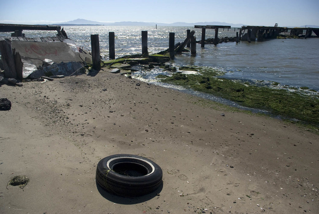
You can't launch from the fishing pier, so use the gravelly beach on the west side of the pier:

There's another gravel beach downstream that has some shade, if you don't mind carrying your gear next to the tracks for a couple of minutes.  I suspect that the water at either beach is very shallow at low tide; there's a probably-up-to-date tide table posted next to the walk at the end of the pier if you need to double-check once you're there.  When the tide's high - maybe 5' plus - there's a beach to the east of the pier, but it turns into a pile of bricks when the water level drops, and I think you'll be better off avoiding it.

Here's the pier, with Glen Cove opposite:

 Looking from the shore at the pier towards the Carquinez bridge:
The big rusty heap next to the pier is the remains of a train ferry called Garden City.  When the tide is really low you can walk thru the mud to the wreck for a photo op.  (Wear shoes, in case there is broken glass and other crap in the mud, but don't wear expensive shoes because they could get stuck.)

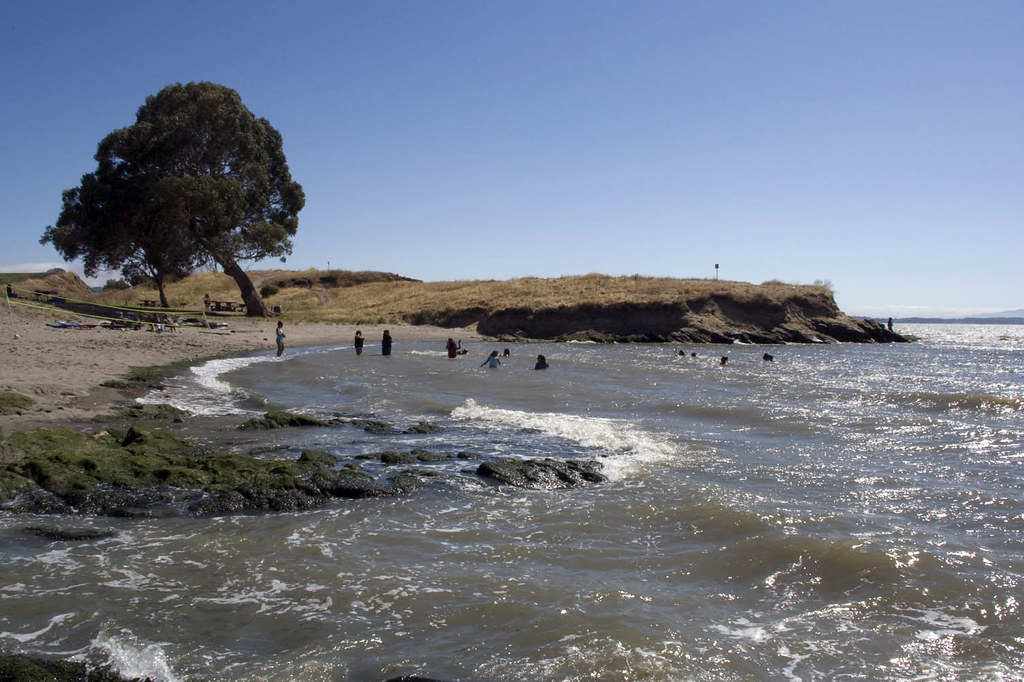
There were once wharves along the shore between Port Costa and Crockett, and now there are hundreds of pilings where the wharves were.  Some of these (especially upstream) may be barely submerged, so look out for those.  And I may as well mention the usual warnings for this area: watch for strong currents and high winds; look both ways before crossing the strait, so you can stay away from tugboats and shipping traffic.  You may upset the people at C&H if you get too close to their waterfront, especially when a ship is arriving or leaving  (but this area should be considered required exploring in spite of that).  It's probably best not to go near the oil terminals (upstream at Martinez and downstream at Selby) either (but that doesn't mean you can't do it anyhow).  The area near the Crockett marina, the Al Zampa bridge, the Cal Maritime campus, and Mare Island can get kind of rough when it's windy (which happens in the afternoon on most summer days).  (This might be more of a problem for those with touring kayaks than for those with modified river kayaks; I don't know, since I've never had a touring kayak.)  And the reserve fleet is off-limits, if you get that far upstream, so be careful not to get caught.


And don't forget to put your cheesy compact digital camera in a plastic bag so you can take fabulous pictures like this:
(This is the one picture that I took from the kayak that wasn't spoiled by water drops on the plastic bag.)

(And while you're there, check out the fabulous panoramic image of the park on the Regional Park signs!
I've heard that the photo credits make especially good reading!  Share and enjoy!)