(This is a work in progress. Suggestions are welcome) Here are (or will be) some more potential and underdocumented places to put in kayaks and canoes. I don't have any experience paddling at these places - I don't much experience paddling at all - so take everything with a grain of salt.
American Canyon
There is a place on the Napa River a bit more that a mile north of the highway 37 bridge, and a bit less than a mile south of the remains of the USS Corry, where a residential area abuts a short slough that connects to the river. I only know this spot from the Google satellite map; I haven't had a chance to go there yet. It seems to me that if there isn't a fence there, one could park on Catalina Circle and launch in the slough next to the road. This is probably a place to avoid at low tide.
Eckley Pier
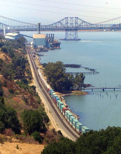
The Eckley pier is on the south side of the Carquinez Strait, west of Port Costa. It's accessible from the Carquinez Strait Regional Shoreline's Bull Valley Staging Area. There's a picnic area, lots of parking, and a fishing pier. There are rocky or gravely beaches on the Carquinez Strait to either side of the pier. There are hundreds of old piles from ruined wharves, and there are the remains of a side-wheel ferry.
There is no boat dock. To launch here you would have to cross the train tracks (Amtrak and other trains pass frequently) and find a rock-and-pile-free spot to launch on the shore; there's a small beach next to the pier (shown in the photo above) that I think would be usable when the tide's in. The shore east of the pier is lined with rip-rap, so launching there is going to be difficult or impossible.
Conditions here are much like they are at Port Costa.
Point Pinole Regional Park
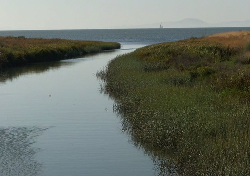
I don't think launching is allowed here, but - I think there are beaches (like the one shown below) near the north-east corner of the park that may be accessible from nearby neighborhoods.
You can reach the beach shown above with a five-or-ten minute walk from a parking lot over asphalt and dirt trails, and over some train tracks. I'm going to go back and take another look around to see if there's street parking near there, since the little regional park parking lot tends to fill up.
Alhambra Creek
Alhambra Creek becomes a tidal slough when the tide is in, and it might be possible to put the kayak in at the creek on the south edge of the Martinez Regional Shoreline, next to the Grainger's Wharf parking lot at the end of Berrellessa Street. There's a muddy bank to cope with, so it might be a better idea to hike to the small beach on the strait (near the remains of the Forester), or to launch from the marina.
There is a restroom and running water at Grainger's Wharf.
The bridge in the picture immediately above crosses a tiny slough that joins Alhambra Creek at one end and disappears in the marshes at the other end. It seems like it ought to be possible - when the tide's in - to paddle under the bridge and a few yards up the slough, and find a spot to sit and take pictures of the birds in the tules.
Thursday, April 8, 2010
Potential kayak put-ins on San Pablo Bay and San Francisco Bay
I've been trying to figure out where I could launch a kayak in Western Contra Costa County. The following is a short list of the places that I might try.
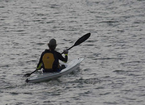
Rodeo, Lone Tree Point
there is a small regional park on the San Pablo Bay shore here with a small sandy beach. There is room for several cars to park by the park entrance. There's an outhouseand running water, and that's it for facilities.
The beach remains sandy when the tide is out, and I think the water is still deep enough to allow launching.
I've seen someone launch a kayak here; he uses a dolly to get his boat to the beach, maybe from the neighborhood adjacent to the park.
Lone Tree Point photos: http://www.flickr.com/search/?q=lone%20tree&w=24215152%40N04
The Rodeo marina
The Rodeo marina seems to be silted in, and impassible at low tide. You might just as well launch at Lone Tree Point.
Rodeo, a bit north of the marina
There is small piece of regional park land, with parking for three or four cars, and another small sand beach. I've seen someone windsurfing here, but I don't know if it's passable when the tide's out. There are no facilities.
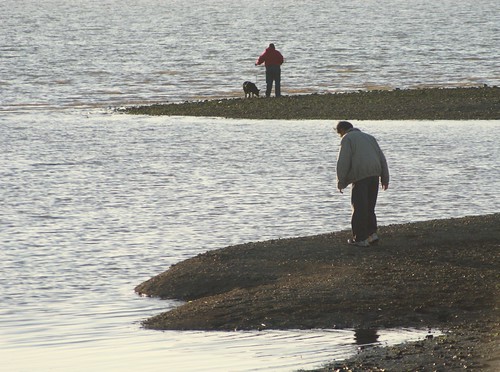
Pinole, Bayfront Park
Bayfront park is (I think) a city park surrounded by regional park land, on the east shore of San Pablo Bay. There's a sandy beach when the tide's in, and a whole lot of mud when the tide's out.
There is a crumbling boat launching ramp on Pinole Creek at the north end of the park, and it might be usable when the tide is in. Where the creek joins the bay there is a gravely-rocky beach that might be usable in a pinch. A bit to the north of the park, there is a sandy beach across the tracks from a residential block, and like the rest of the area it's probably too shallow to be usable when the tide's out.
Albany, the Albany Bulb beach
At the north-west corner of the Golden Gate Fields lot there is a beach that's popular with dog-walkers and kitesurfers. It seems like it should be usable when the tide's out, and it might be somewhat sheltered from the chop that comes with the afternoon wind. There's plenty of room to park, and I think it has an outhouse and a water tap.

Rodeo, Lone Tree Point
there is a small regional park on the San Pablo Bay shore here with a small sandy beach. There is room for several cars to park by the park entrance. There's an outhouse
The beach remains sandy when the tide is out, and I think the water is still deep enough to allow launching.
I've seen someone launch a kayak here; he uses a dolly to get his boat to the beach, maybe from the neighborhood adjacent to the park.
Lone Tree Point photos: http://www.flickr.com/search/?q=lone%20tree&w=24215152%40N04
The Rodeo marina
The Rodeo marina seems to be silted in, and impassible at low tide. You might just as well launch at Lone Tree Point.
Rodeo, a bit north of the marina
There is small piece of regional park land, with parking for three or four cars, and another small sand beach. I've seen someone windsurfing here, but I don't know if it's passable when the tide's out. There are no facilities.

Pinole, Bayfront Park
Bayfront park is (I think) a city park surrounded by regional park land, on the east shore of San Pablo Bay. There's a sandy beach when the tide's in, and a whole lot of mud when the tide's out.
There is a crumbling boat launching ramp on Pinole Creek at the north end of the park, and it might be usable when the tide is in. Where the creek joins the bay there is a gravely-rocky beach that might be usable in a pinch. A bit to the north of the park, there is a sandy beach across the tracks from a residential block, and like the rest of the area it's probably too shallow to be usable when the tide's out.
Albany, the Albany Bulb beach
At the north-west corner of the Golden Gate Fields lot there is a beach that's popular with dog-walkers and kitesurfers. It seems like it should be usable when the tide's out, and it might be somewhat sheltered from the chop that comes with the afternoon wind. There's plenty of room to park, and I think it has an outhouse and a water tap.
Labels:
Albany Bulb,
Bayfront Park,
beach,
kayak,
Lone Tree Point,
Pinole,
put-in,
Rodeo,
San Francisco Bay,
San Pablo Bay
Subscribe to:
Comments (Atom)
